Orange & Rockland Gas Line Replacement – New York State Route 17
Orange & Rockland Utilities, Inc.
Sloatsburg, NY
September 2017
N/A
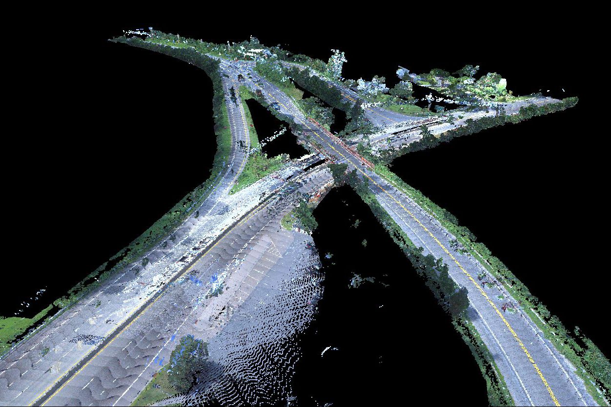
Tectonic performed a topographic survey of approximately 6,900 LF of roadway along New York State Route 17 in Sloatsburg, NY. The survey was used for the design of the replacement of an existing old gas line.
Route 17 is a major commuter road with heavy traffic volumes in the morning and early afternoon. Due to this high volume of traffic, Tectonic used its Mobile LiDAR Mapping system to collect topographic data at posted highway speeds without risking survey personnel in traffic to obtain the data. The base data was collected during a two-hour time span between times of heavy commuter traffic. Control was set using GNSS receivers linked to the NYSDOT Continuously Operating Reference Station (CORS) network to assure and check the accuracy of data obtained. The data gathered by our Mobile Mapping system exceeded the accuracy requirement. All maps were field checked by survey crews to ensure completeness, and final maps were produced using AutoCAD Civil 3D. Additionally, field crews measured inverts of drainage and sanitary sewer structures and incorporated the measurements in the final mapping.